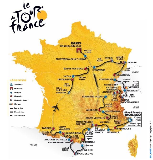
From Saturday 4 to Sunday, July 26, 2009 will be held on the 96th Tour de France 2009 , which includes 21 steps for a distance of approximately 3500 kilometers.
How can you resist the urge to show the animation map of the route to be followed this year by riders and caravan
On the official website of the "Great Loop," the Tour 2009 is reproduced on a relief map in colors yellow color of the jersey requires the winner.
(Copyright ASO)
map Tour has even been reproduced on a T-shirt "ESSENTIAL!" (20 € Map ... still is money).

(Copyright ASO)
plots of each step gives rise to map illustrations that rely on mapping Geoatlas example below for the first step Monaco -> Monaco:
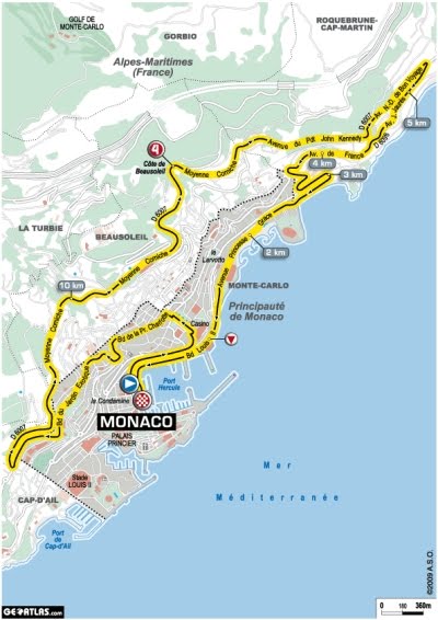
(Copyright ASO)
The profiles are also available:
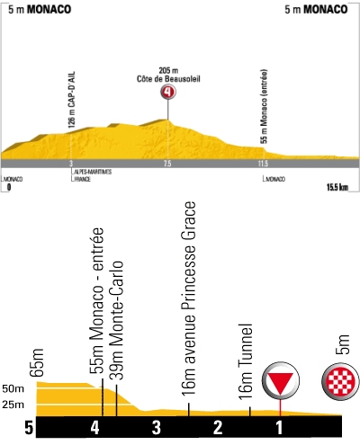
(Copyright ASO) You will find here
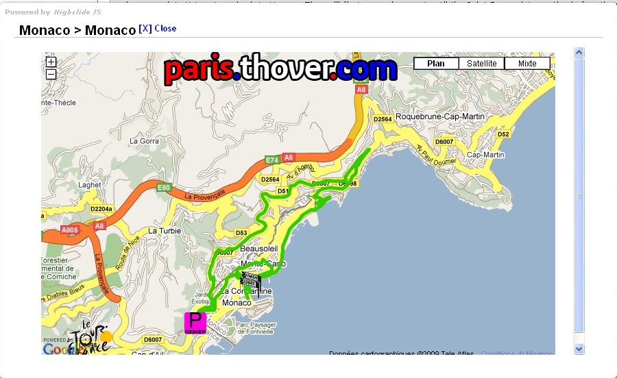
file. kml that tracks the Tour in Google Earth, step by step. Of course, the course has also been reproduced on Google Maps as a whole ...

... and step by step:
There is also a Flash version here:

Personally, for several years, my preference is for another Tour de France: "Tour de France with two children" , a reader of Augustine Fouillee school, called G. Bruno, published for the first time in 1877 and I have a copy from me that read and reread "staged".
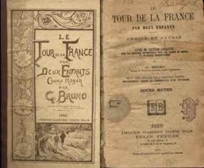
This book was a huge best-seller (8.6 million copies sold), especially because he was "adopted and recommended for school libraries and on the list of books donated by the City of Paris to its municipal schools. .
Can be found here on the site of an article by Valerie Clionautes Fossar, a sort of critical summary of the book, which I borrow the opening lines:
"Through reading the adventures of two young orphans Lorraine, whose ages foster an identification process for students to cycle 3 (Julian is 7 years old) and college (Andrew 14), the book discusses the history of France from its "big characters" yet studied school today (Vercingetorix, Joan of Arc, ...) but also provides information on the nineteenth-century France, between industrialization (...) More traditional crafts and highlighted by the story (...). It depicts a society committed to values constantly reminded of sub-chapter headings (...)".
can also find here an article by J. and M. Ozouf "The Tower France by two children, The Little Red Book of the Republic " ( in places of memory, Book I: The Republic, under the direction of Pierre Nora, Paris, Gallimard, 1984).
can be found here , free full text and illustrations for several publications including the 1877 and 1923. When comparing the two editions, it is interesting to note the deletion of any reference to God, religion, its manifestations, its monuments, which occurred from the 1906 edition, after the promulgation of the 1905 Act on the separation of church and State .
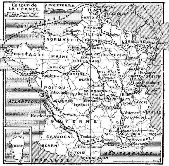
The book contains twenty maps of regions of France covered by the two children, listed in an index card. A gazetteer of place names mentioned in the text is also available.
(Source here )
From this map of a Tour de France, certainly from another era, but was released for free child and that of the next Tour de France which costs 20 € for the version printed on t-shirt, my preference is definitely the first ...


